 |
 |
|
|
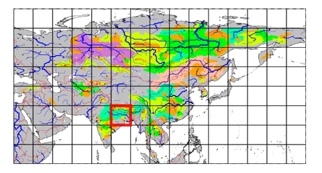
| Station Name (GRDC ID): | Benighat (2548450) | Basin Name: | Ganges |
|---|---|---|---|
| River Name: | Karnali River | Next Downstream Station: | Chisapani (2548400) |
| GRDC Country Code: | NE | Distance to Next Downstream Station: | 185 km |
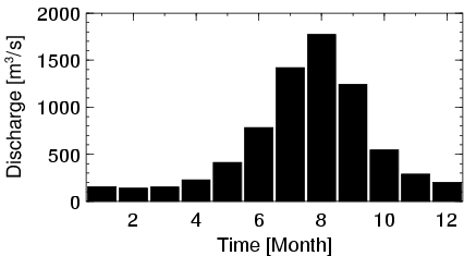
| Start Year [Month]: | 1963 [1] | Upstream Station(s): | None |
| End Year [Month]: | 1993 [12] | ||
| Mean Discharge: | 613 m3/s | ||
| Minimum Discharge: | 96 m3/s | ||
| Maximum Discharge: | 2250 m3/s | Length of Upstream Mainstem: | 269 km |
| Mean Interstation Discharge: | 613 m3/s | Distance to Basin Outlet: | 1493 km |
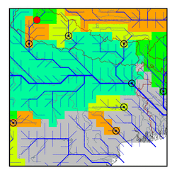
| GRDC Catchment Area: | 21240 km2 | STN Catchment Area: | 24154 km2 |
| GRDC Interstation Area: | 21240 km2 | STN Interstation Area: | 24154 km2 |
| GRDC Station Runoff: | 909 mm/yr | STN Station Runoff: | 800 mm/yr |
| GRDC Interstation Runoff: | 909 mm/yr | STN Interstation Runoff: | 800 mm/yr |
| Station Field Descriptions | Basin Field Descriptions | ||
| Download | |
|---|---|
| Site Descriptor Information | Station Time Series Data |
| Hydrograph | Station Data | ||||||||||||||||||||||||||||||||||||||||||||||||||||||||
|---|---|---|---|---|---|---|---|---|---|---|---|---|---|---|---|---|---|---|---|---|---|---|---|---|---|---|---|---|---|---|---|---|---|---|---|---|---|---|---|---|---|---|---|---|---|---|---|---|---|---|---|---|---|---|---|---|---|
|
| ||||||||||||||||||||||||||||||||||||||||||||||||||||||||