 |
 |
|
|
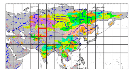
| Station Name (GRDC ID): | Hodjikent (2916550) | Basin Name: | Syr-Darya |
|---|---|---|---|
| River Name: | Chirchik | Next Downstream Station: | Tyumen-Aryk (2916200) |
| GRDC Country Code: | UZ | Distance to Next Downstream Station: | 555 km |
| Start Year [Month]: | 1935 [1] | Upstream Station(s): | None |
| End Year [Month]: | 1985 [12] | ||
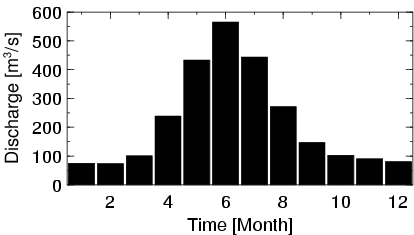
| Mean Discharge: | 218 m3/s | ||
| Minimum Discharge: | 49 m3/s | ||
| Maximum Discharge: | 1220 m3/s | Length of Upstream Mainstem: | 194 km |
| Mean Interstation Discharge: | 218 m3/s | Distance to Basin Outlet: | 1179 km |
| GRDC Catchment Area: | 10900 km2 | STN Catchment Area: | 11495 km2 |
| GRDC Interstation Area: | 10900 km2 | STN Interstation Area: | 11495 km2 |
| GRDC Station Runoff: | 632 mm/yr | STN Station Runoff: | 599 mm/yr |
| GRDC Interstation Runoff: | 632 mm/yr | STN Interstation Runoff: | 599 mm/yr |
| Station Field Descriptions | Basin Field Descriptions | ||
| Download | |
|---|---|
| Site Descriptor Information | Station Time Series Data |
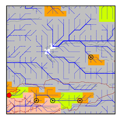
| Hydrograph | Station Data | ||||||||||||||||||||||||||||||||||||||||||||||||||||||||
|---|---|---|---|---|---|---|---|---|---|---|---|---|---|---|---|---|---|---|---|---|---|---|---|---|---|---|---|---|---|---|---|---|---|---|---|---|---|---|---|---|---|---|---|---|---|---|---|---|---|---|---|---|---|---|---|---|---|
|
| ||||||||||||||||||||||||||||||||||||||||||||||||||||||||