 |
 |
|
|
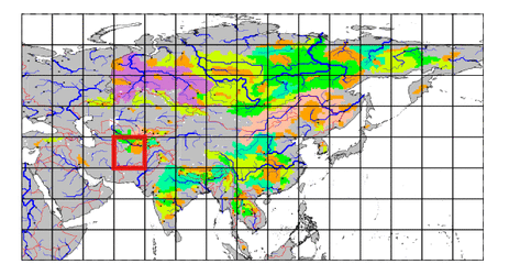
| Station Name (GRDC ID): | Dupuli (2917450) | Basin Name: | Amu-Darya |
|---|---|---|---|
| River Name: | Zaravchan | Next Downstream Station: | Chatly (2917100) |
| GRDC Country Code: | TA | Distance to Next Downstream Station: | 957 km |
| Start Year [Month]: | 1932 [1] | Upstream Station(s): | None |
| End Year [Month]: | 1995 [3] | ||
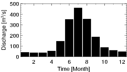
| Mean Discharge: | 155 m3/s | ||
| Minimum Discharge: | 26 m3/s | ||
| Maximum Discharge: | 661 m3/s | Length of Upstream Mainstem: | 199 km |
| Mean Interstation Discharge: | 155 m3/s | Distance to Basin Outlet: | 1288 km |
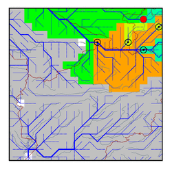
| GRDC Catchment Area: | 10200 km2 | STN Catchment Area: | 11918 km2 |
| GRDC Interstation Area: | 10200 km2 | STN Interstation Area: | 11918 km2 |
| GRDC Station Runoff: | 479 mm/yr | STN Station Runoff: | 410 mm/yr |
| GRDC Interstation Runoff: | 479 mm/yr | STN Interstation Runoff: | 410 mm/yr |
| Station Field Descriptions | Basin Field Descriptions | ||
| Download | |
|---|---|
| Site Descriptor Information | Station Time Series Data |
| Hydrograph | Station Data | ||||||||||||||||||||||||||||||||||||||||||||||||||||||||
|---|---|---|---|---|---|---|---|---|---|---|---|---|---|---|---|---|---|---|---|---|---|---|---|---|---|---|---|---|---|---|---|---|---|---|---|---|---|---|---|---|---|---|---|---|---|---|---|---|---|---|---|---|---|---|---|---|---|
|
| ||||||||||||||||||||||||||||||||||||||||||||||||||||||||