 |
 |
|
|
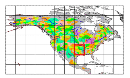
| Station Name (GRDC ID): | Desoto, Kans. (4122700) | Basin Name: | Mississippi |
|---|---|---|---|
| River Name: | Kansas | Next Downstream Station: | Hermann, Mo. (4122900) |
| GRDC Country Code: | US | Distance to Next Downstream Station: | 443 km |
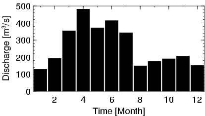
| Start Year [Month]: | 1973 [1] | Upstream Station(s): | None |
| End Year [Month]: | 1984 [12] | ||
| Mean Discharge: | 263 m3/s | ||
| Minimum Discharge: | 24 m3/s | ||
| Maximum Discharge: | 1460 m3/s | Length of Upstream Mainstem: | 907 km |
| Mean Interstation Discharge: | 263 m3/s | Distance to Basin Outlet: | 1692 km |
| GRDC Catchment Area: | 154768 km2 | STN Catchment Area: | 167148 km2 |
| GRDC Interstation Area: | 154768 km2 | STN Interstation Area: | 167148 km2 |
| GRDC Station Runoff: | 54 mm/yr | STN Station Runoff: | 50 mm/yr |
| GRDC Interstation Runoff: | 54 mm/yr | STN Interstation Runoff: | 50 mm/yr |
| Station Field Descriptions | Basin Field Descriptions | ||
| Download | |
|---|---|
| Site Descriptor Information | Station Time Series Data |
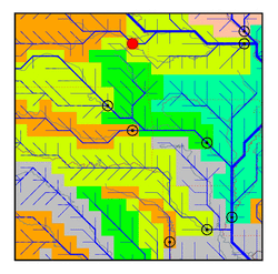
| Hydrograph | Station Data | ||||||||||||||||||||||||||||||||||||||||||||||||||||||||
|---|---|---|---|---|---|---|---|---|---|---|---|---|---|---|---|---|---|---|---|---|---|---|---|---|---|---|---|---|---|---|---|---|---|---|---|---|---|---|---|---|---|---|---|---|---|---|---|---|---|---|---|---|---|---|---|---|---|
|
| ||||||||||||||||||||||||||||||||||||||||||||||||||||||||